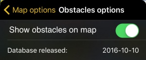
You can filter the obstacles by the vertical separation between them and your current altitude. You can also check the release date of the database.
Contents
Obstacles options
Show obstacles on map
Will show or hide the obstacles on the moving map.
Database released:
Will display the date of release of the obstacles' database.
Obstacles filter
By touching the button on the bar and dragging left or right you will be able to filter the obstacles shown on the moving map according to your current altitude and the value you set on the filter. When the filter is in full right position, all obstacles will be shown.
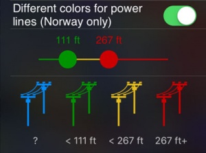
Power lines colors
This function allows you to change the color of the power lines according to their altitude. By touching and dragging right and left the colored circles, you can toggle between the different colors.
Note: Please note that this feature is only available for Norway.
Troubleshooting
- No obstacles are shown on the Moving Map
- Make sure that you have correctly acquired the Obstacles database subscription in Xample Services and you have turned on the option "Show obstacles on Map".
- Obstacles are out of date
- Check in the Map Store if there is an update available for the Obstacles database.
- I acquired the Obstacles Database via Xample Services but I'm not able to install it
- Check that you are correctly connected to your Xample Services account under Tools - Air Navigation Services. Install the database from the Map Store - All my products menu.
Back to previous page.


