| Line 12: | Line 12: | ||
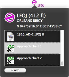
| − | + | The approach chart can be opened as a PDF document. Or it can be displayed on the map to better plan the route. In both cases, you have to '''select them in the info window''' of the airport waypoint. | |
| − | + | ||
[[File:geo_mac2.jpg|caption|left]] Ceci est un exemple qui montre comment ouvrir et géoréférencer la carte d’approche de l’aérodrome LFOJ. | [[File:geo_mac2.jpg|caption|left]] Ceci est un exemple qui montre comment ouvrir et géoréférencer la carte d’approche de l’aérodrome LFOJ. | ||
| Line 34: | Line 33: | ||
---- | ---- | ||
<br /> | <br /> | ||
| − | Retourner à <u>[[Air Navigation Desktop|l'index]]</u>. | + | Retourner à <u>[[Air Navigation Desktop/fr|l'index]]</u>. |
<br /> | <br /> | ||
Revision as of 17:51, 4 November 2015
Air Nav Desktop prend en charges les cartes d'approche géoréférencées.
caption Las cartes d’approche géoréférencées sont offerts sous la forme d’abonnements payés et doivent être achetées depuis un compte de Xample Services.
The approach chart can be opened as a PDF document. Or it can be displayed on the map to better plan the route. In both cases, you have to select them in the info window of the airport waypoint.
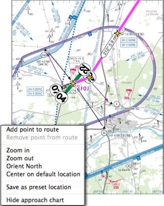
Right-click on the map and select "Hide approach chart" from the pop-up window to remove the chart from the screen.
Retourner à l'index.

