(Created page with "* Activar la opción «Servicio de seguimiento» desde el menu «Herramientas»; * Estar conectado a su cuenta de usuario. <br /> ---- <u>'''Nota:'''</u> El seguimiento de vue...") |
|||
| Line 14: | Line 14: | ||
[[File:danger.jpg]] ara evitar inconvenientes, asegurarse de: | [[File:danger.jpg]] ara evitar inconvenientes, asegurarse de: | ||
| − | * | + | * Activar la opción «Servicio de seguimiento» desde el menu «Herramientas»; |
| − | * | + | * Estar conectado a su cuenta de usuario. |
| − | <br/> | + | <br /> |
---- | ---- | ||
| − | <u>''' | + | <u>'''Nota:'''</u> El seguimiento de vuelo online funcionará siempre y cuando se disponga de red 3G/4G. |
---- | ---- | ||
Revision as of 12:57, 22 October 2015
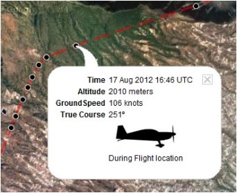
Air Nav Pro enviará datos de información con altitud, rumbo, hora y velocidad a nuestros servidores en tiempo real. Dicha información puede ser compartida con amigos o familiares que estén conectados a su Cuenta de usuario durante el vuelo o después del mismo.
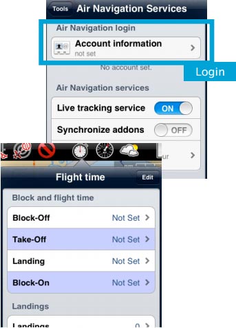
El vuelo comenzará a grabarse en la cuenta de usuario una vez que el tiempo Block-off se haya establecido en el menú «Tiempos de vuelo». Recuerdo que puede ser automáticamente configurado en los ajustes.Una vez que el Block-off es establecido, Air Nav Pro grabará el vuelo en vivo desde tu cuenta tu cuenta de usuario. La grabación finalizará tan pronto se establezca el tiempo Block-on
File:Danger.jpg ara evitar inconvenientes, asegurarse de:
- Activar la opción «Servicio de seguimiento» desde el menu «Herramientas»;
- Estar conectado a su cuenta de usuario.
Nota: El seguimiento de vuelo online funcionará siempre y cuando se disponga de red 3G/4G.
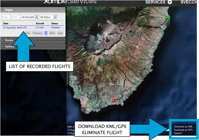
Each recorded flight will be stored on the left bar in the «AIRNAVIGATION» section of the User Account website. It can be downloaded as a KML file or as a GPX file from the right side of the bottom data bar. You can also delete a flight.
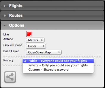
It is possible to keep the flight private or share it with family or friends with a password or set it as “public”. This can be configured from the «Options» tab on the left bar.
From this tab, it is also possible to change the units for altitude and speed, change the color of the track line and even switching to a bunch of varied map backgrounds.
Back to index


