| Line 2: | Line 2: | ||
<br /> | <br /> | ||
---- | ---- | ||
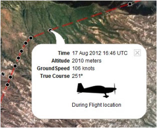
| − | + | La aplicación envía los puntos a través del servidor en '''Tiempo Real''' mientras se realiza el vuelo. Al mismo tiempo, una persona conectada con su '''<u>[[The User Account/es|Cuenta de Usuario]]</u>''' podrá revisar aquellos puntos que rastrean el camino del viaje y que tienen información relevante como altitud actual, curso y hora. | |
[[File:flightloc.jpg]] | [[File:flightloc.jpg]] | ||
Revision as of 15:27, 25 November 2015
La aplicación envía los puntos a través del servidor en Tiempo Real mientras se realiza el vuelo. Al mismo tiempo, una persona conectada con su Cuenta de Usuario podrá revisar aquellos puntos que rastrean el camino del viaje y que tienen información relevante como altitud actual, curso y hora.
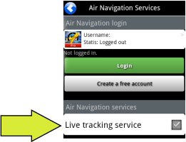
caption Para ser uso de esta herramienta:
- Iniciar sesión con su cuenta de
usuario;
- Activar la opción «Live tracking service» desde el menú «Tools».
File:Danger.jpg To avoid issues, make sure to:
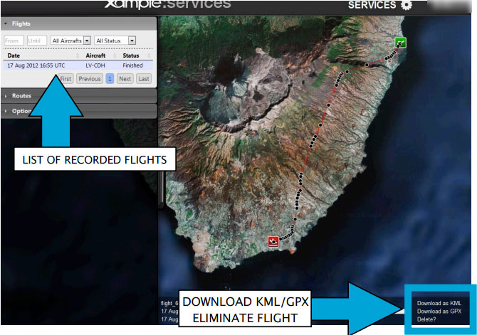
Cada vuelo grabado se almacena en la barra a la izquierda en la página AIRNAVIGATION de Xample Services. El mismo puede descargarse como un archivo KML o GPX desde la esquina derecha de la barra de datos inferior. También puede borrar un vuelo.
Each recorded flight will be stored on the left bar in the «AIRNAVIGATION» section of the User Account website. It can be downloaded as a KML file or as a GPX file from the right side of the bottom data bar. You can also delete a flight.
Volver al índice.
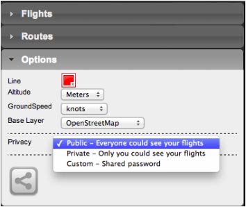
It is possible to keep the flight private or share it with family or friends with a password or set it as “public”. This can be configured from the «Options» tab on the left bar.
From this tab, it is also possible to change the units for altitude and speed, change the color of the track line and even switching to a bunch of varied map backgrounds.
Back to index (Android)
Back to index (iOS)


