(Created page with "La carta tendrá cuatro páginas:<br /> __TOC__ <br /> ===== Salida/Aproximación ===== 200pxEn esta página tendrá acceso a las cartas y do...") |
|||
| Line 29: | Line 29: | ||
Presionando sobre una de las pestañas, se mostrará una carta con información relacionada al waypoint. Para cerrarla, será suficiente con tocar en cualquier parte del mapa. | Presionando sobre una de las pestañas, se mostrará una carta con información relacionada al waypoint. Para cerrarla, será suficiente con tocar en cualquier parte del mapa. | ||
| − | + | La carta tendrá cuatro páginas:<br /> | |
__TOC__ | __TOC__ | ||
<br /> | <br /> | ||
| − | ===== | + | ===== Salida/Aproximación ===== |
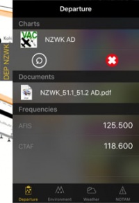
| − | [[File:Docks.3.jpg|caption|left|200px]] | + | [[File:Docks.3.jpg|caption|left|200px]]En esta página tendrá acceso a las cartas y documentos (*). También podrá ver las frecuencias del aeródromo.Al presionar en una carta, la misma se desplegará en el mapa móvil.Presionando en la cruz roja, la carta se cerrará. Presionando sobre la flecha circular, se cambiará a la carta siguiente. |
<br /> | <br /> | ||
<br /> | <br /> | ||
Revision as of 18:56, 17 December 2015
Las pestañas ofrecen un acceso rápido a información relevante sobre la salida, llegada y aeropuerto alterno.
Estas pestañas aparecerán en el costado derecho del mapa móvil luego de que una ruta sea creada o cargada.
Nota: Es posible configurar un aeropuerto alterno presionando en el resumen de rutas y agregando el ID del aeródromo en el campo alterno.
Existen tres tipos de pestañas:
- DEP
- ARR
- ALTN
Presionando sobre una de las pestañas, se mostrará una carta con información relacionada al waypoint. Para cerrarla, será suficiente con tocar en cualquier parte del mapa.
La carta tendrá cuatro páginas:
Salida/Aproximación
En esta página tendrá acceso a las cartas y documentos (*). También podrá ver las frecuencias del aeródromo.Al presionar en una carta, la misma se desplegará en el mapa móvil.Presionando en la cruz roja, la carta se cerrará. Presionando sobre la flecha circular, se cambiará a la carta siguiente.
Environment
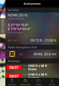
Will show information about the location of the airfield and surroundings:- Height
- Coordinates
- Sunrise/Sunset time
- Radio Navigation Aids: distance and radial
- Runways
- Obstacles (*)
Weather
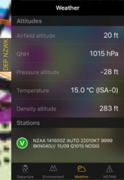
Gathers weather information from the weather stations next to the airfield. The app will calculate altitudes taking in account the current weather. It will also show the METAR. By tapping on a station you will be able to see the report including the TAF.
NOTAM
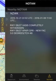
Nearby notams will be shown. For this page to work you will need to request a briefing first. (*)
Note: If information is missing (weather, NOTAM, etc.), change to the EDIT MODE and go back to flight mode. This will refresh the data of the docks.
Docks can be disabled under "Settings" - "Show route info drawers".
(*) Subscriptions to the mentioned services will be required in order for these functions to work (Preflight Briefing, Approach Charts, Obstacles Database).
Back to index.


