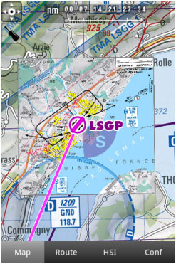
Air Navigation Pro es compatible con cartas de aproximación geo-referenciadas que se pueden abrir directamente sobre el mapa.
Ofrecemos 1 año de suscripción que incluye un paquete con:
- Cartas de aproximación geo-referenciadas (se abrirán en el mapa)
- Cartas formato PDF (contienen información adicional para complementar la carta de aproximación)
- Actualizaciones regulares de acuerdo con los ciclos Amendment.
Para comprar una suscripción, lea el capítulo “Instalación”.
The Approach Chart package brings:
- Geo-referenced approach chart (it will be opened on the map).
- Chart PDF Document (it has additional info to complement the approach chart).
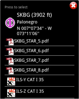
Both can be opened by selecting a waypoint on the map. As an example, we selected the waypoint SKBG from the moving map. The files from the top are the PDF documents, while the files at the bottom are the geo-referenced approach charts classified by IFR or VFR (instrumental or visual).
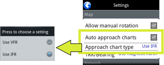
We will set the class of the approach (VFR/IFR) chart we want to use in the Settings panel, where the user can also enable or disable the option «Auto approach chart». When enabled, the geo-referenced approach charts will be opened on the map automatically by Air Nav Pro for the destination waypoint.
Example: if I create a Route: SKBG - SKBO - SAEZ.
If we have downloaded the approach charts for SAEZ, then an approach chart will pop up on the map when SAEZ is our next selected waypoint.
Back to index.


