Vous pouvez interagir sur la carte défilante avec tout ce qui est affiché à l’écran.
Contents
Boussole
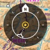
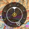
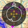
L’icône de boussole en haut à droite indique de façon graphique l’orientation de la carte, la direction de votre vol et le mode sélectionné. Toucher l’icône fait passer d’un mode à l’autre.
Nord en haut
La carte défilante est orientée au nord. Votre position actuelle sera au centre de la carte. Notez que la flèche blanche “N” est blanche.
Dans le sens du vol
La carte est orientée selon la direction de votre vol et sera centrée sur votre position actuelle. Notez que la ligne du tracé est maintenant blanche.
Mode manuel
Le mode passe automatiquement en manuel en bougeant la carte. L’icône de la boussole montre alors quatre flèches. Dans ce mode, toucher la boussole centrera à nouveau la carte sur votre position.
Si la fonction "Permettre la rotation manuelle" est activée, le mode manuel sera aussi activé par la rotation de la carte.
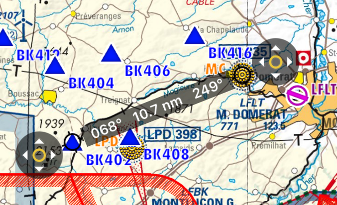
Règle
Toucher deux endroits en même temps pendant deux secondes fait apparaître la règle. Vous pouvez mesurer la distance et le cap vrai entre deux points.
La règle est “magnétique”; elle se colle au waypoint le plus proche et à votre appareil (mais ne le suivra pas quand il bouge).
Vous pouvez déplacer un des bouts de la règle en touchant le symbole à 4 flèches.
Toucher la carte n’importe où fait disparaître la règle.
Rotate
Move two fingers around each other to rotate the view of the map. Remember that this function has to be enabled from "Settings" menu.
Zoom in / out
Pinch with two fingers to zoom in or out. You can also swipe left or right on the scale to zoom in or out or tap on the "+" "-" symbols.
Screen lock / notepad
It is possible to lock the screen by swiping three fingers from right to left over the moving map and use it as a notepad.
Out of screen symbol
When the aircraft is out of the screen, a symbol will be shown on the edge of the moving map in the direction where the aircraft is. You can tap on the symbol to center the aircraft on the screen again.
Airspaces and waypoints
You can tap on the airspaces and waypoints on the moving map to gather more information about them.
Troubleshooting
- The map looks yellow and red, not like the original map
- This happens when the option "Terrain awareness 2D/3D" is turned on. Air Navigation will show terrain at your current altitude in yellow and terrain above your current altitude in red. This is very useful in flight but can be a bit disturbing while planning your flight on the ground. You can disable it from Map Options.
For more information about what can be done in the Moving Map, please refer to Map Options.
Back to previous page.
