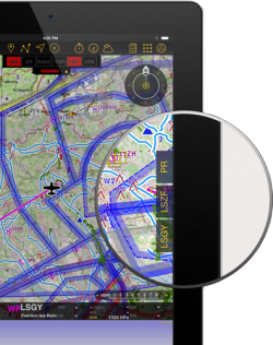
Le dock vous propose un accès rapide à des informations pertinentes sur le Départ, l’Arrivée et les aéroports alternants.
Elles apparaîtront sur le côté droit de la carte défilante, dès qu’une route aura été crée ou téléchargée.
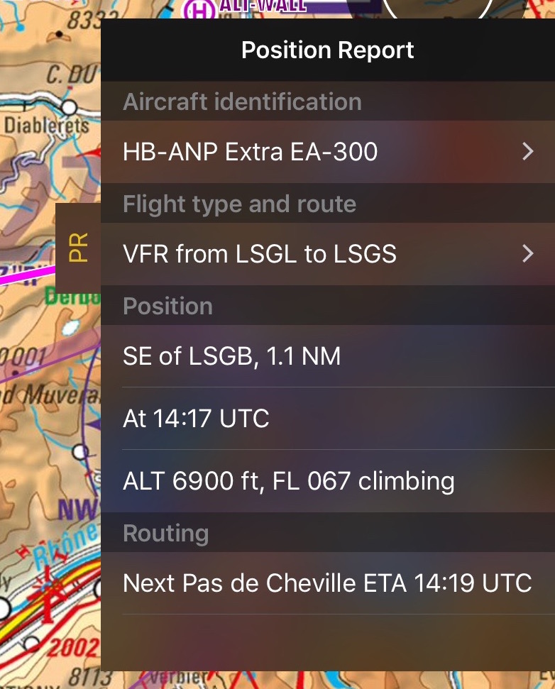
The Position Report is always shown.
Note: Vous pouvez régler un autre aéroport en tapant sur la route pour entrer l’ID du terrain d’aviation dans le champ alternatif.
Il y a trois sortes de docks:
- PR
- DEP
- ARR
- ALTN
En cliquant sur un de ces docks, un onglet apparaîtra avec des informations relatives au waypoint. Pour fermer cet onglet, appuyez simplement n’importe où sur la carte.
Note: Please note that iPhone's docks will only be visible in iPhone 6 and others with bigger screens.
PR Position Report
The purpose of this dock is to help you when contacting ATC on the initial call. It will display your current position and intentions in a manner that will quickly let you transmit it over the radio.
Airports Docks
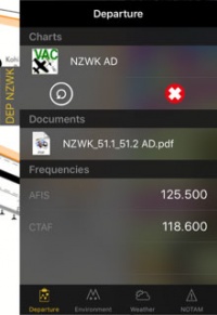
The DEP, ARR and ALTN tabs have four pages:
Contents
Departure/Approach
On this page you will have access to the charts and documents (*). You will also see the frequencies of the airfield. When tapping on the chart, it will be displayed on the moving map. By tapping on the red cross the chart will be closed. Tapping on the circled arrow will change to the next chart.
You can also see personal .pdf documents that were attached to the airfield.
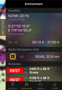
Environnement
Vous montrera des informations sur la localisation du terrain d’aviation et de son périphérique:- Altitude
- Coordonnées
- Heure du lever et du coucher du soleil
- Balises de radionavigation: distance et radius
- Pistes
- Obstacles (*)
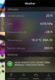
Temps
Récolter des informations météo de stations météo proches des terrains d’aviation. L’application calculera l’altitude en prenant en compte le temps actuel. Elle affichera également les METAR. En tapant sur une station, vous pourrez alors voir le rapport incluant le TAF.
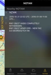
NOTAM
Les NOTAMS à proximité seront montrés. Pour que cette page fonctionne vous devrez d’abord avoir téléchargé un briefing. (*)
Note: Si des informations manquent (temps, NOTAM, etc.), basculez en mode édition et retournez au mode de vol. Cela rafraîchira les données du dock.
Le dock peut être désactivé depuis «Réglages» - «Afficher les tirettes informatives».
(*) Les abonnements mentionnés dans ce service devront être acquis pour pouvoir fonctionner (Briefing de Pré-vol, cartes d’approche, Base de données d’obstacles).
Retourner à la page précédente.
