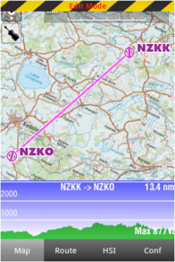
In «Edit mode», the Elevation Graph will display the terrain between the two waypoints of the selected leg. On the screenshot beside, the terrain profile is displayed for the leg NZKK-NZKO with a total distance of 13.4 NM.
This is very useful when planning your route, to get an estimate of the minimum safe altitude.
