The instrument "Route" is one of the main features present in Air Navigation for flight planning and real time navigation. It displays the most important data for the created route.
Summary
- General
- Route
- Fuel
- Wind
Legs
Operational Flightplan
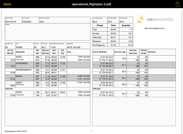
The route created can be converted to a flight log that can be printed out or sent by E-Mail.
To use this function just tap on the Summary of the route and select the option "Flightplan" at the top right corner.
The flight log will display route information in an easy to read table mode together with other relevant information like MSA, FREQs, TAS, GS and Fuel requirements.
To print, send or share the Operational Flightplan just tap on the icon with the arrow on the upper right corner.
Back to index
