You can show/hide/overlay previously downloaded maps. Air Navigation Pro's map engine is capable of displaying multiple maps at the same time. It means that you can MIX maps from different providers and use them all at the same time.
Overlaying
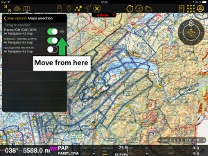
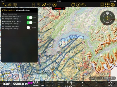
In the screenshot on the right, we show both the chart “France IGN ICAO 2015” and the chart “Switzerland 2014” one on top of the other. The problem looks like if the French chart is missing a part, but actually, it is not. This is a clear example of OVERLAYING.You can solve this problem by simply moving the charts up or down in the «Maps» panel or switching them ON or OFF. On the picture on the right, we show the chart from Switzerland on top of the one from France. So, if we move it below, the latter will show on top of the former. This is shown on the picture above. We move the charts by pressing and holding from the right edge (where the three-line mark is).
Remember that is necessary to enable the charts from this section to see them in the moving map.
Back to index

