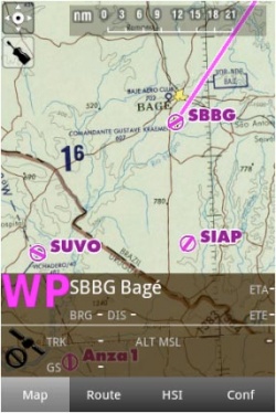
Pode criar uma rota a partir do mapa móvel. É possível adicionar waypoints enquanto você está voando (para evadir condições climáticas adversas).
Por padrão, o mapa móvel está centrado na sua localização atual, orientação norte. Pressionando no símbolo na quina superior esquerda, você pode escolher entre:
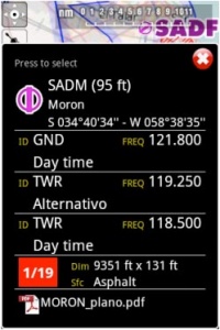
Touching an area of interest on the map will reveal a popup window with useful information. Touchable or interactive items are:
Waypoints: elevação, tipo, nome completo para Navaids e freqüência. Para os aeroportos, você terá informação da pista e da freqüência, cartas de aproximação geo- referenciadas.
Airspaces: limites inferiores e superiores, nome, tipo e informação adicional. Estes espaços aéreos são exibidos no mapa em cores diferentes de acordo com a sua classificação.
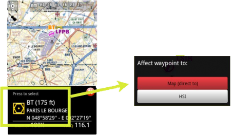
No mapa, você pode pressionar o waypoint que você quiser para selecioná-lo com o HSI ou para seleciná-lo como seu destino, pressionando onde diz: Press to select
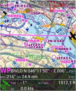
A barra de dados que fica na parte inferior do mapa móvel exibirá informação em tempo real tal como o waypoint seguinte (identificador, nome, direção, distancia e tempo estimado), velocidade atual captada pelo GPS (velocidade de terreno), percurso do avião, altitude captada pelo GPS e qualidade do sinal do GPS.
The data bar also shows a GPS signal symbol as follows:
Excellent GPS signal
Good GPS signal
Weak GPS signal
Very week GPS signal
For real time navigation, the quality of the GPS signal is required to be a green or yellow symbol. A red or orange symbol will only show an approximate location and will not report speed nor track information.For better results, place your device near a window, with a direct view of the sky. If you are flying with a full-metal airplane or your airplane is equipped with anti-ice windshield, the internal GPS of your tablet/mobile may be a bit weak and you may need an external GPS device to assist it.
Back to index.


