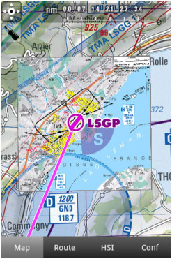
Air Navigation Pro ist mit georeferezierte Anflugkarten kompatibel. Die können gleich auf der Moving Map eröffnet werden.
Wir bieten 1 Jahres-Abonnement, mit folgendem Inhalt :
- Georeferenzierte Anflugkarten (werden direkt auf der Karte eröffnet)
- PDF-Format Karten (enthält zusätzliche Informationen um eine Anflugkarte zu erweitern, z.B.: Karte des Flugplatz, Rollkarte, usw.)
- Regelmäßige Updates (Airac Cycle)
Um diese Pakete zu erwerben, lesen Sie bitte das Kapitel Installation.
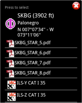
Both can be opened by selecting a waypoint on the map.
As an example, we selected the waypoint SKBG from the moving map. The files from the top are the PDF documents, while the files at the bottom are the geo-referenced approach charts classified by IFR or VFR (instrumental or visual).
Example: if I create a Route: SKBG - SKBO - SAEZ.
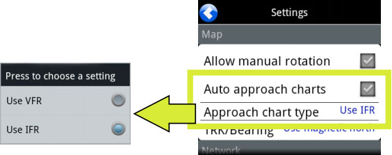
If we have downloaded the approach charts for SAEZ, then an approach chart will pop up on the map when SAEZ is our next selected waypoint.
Back to index.


