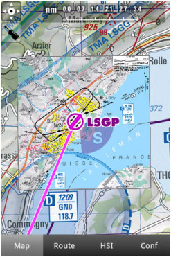
Air Navigation Pro supports geo-referenced approach charts that can be opened directly over the map.
We offer a 1-year-subscription package that includes:
- Geo-referenced Approach Charts to be used on the map.
- Approach Charts PDF documents (with additional info).
- Regular updates according to the Amendment cycles.
To purchase a subscription, read the article Installation.
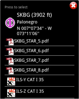
Ambos os tipos de arquivos podem ser abertos ao selecionar um waypoint do mapa.
Por exemplo, nós selecionamos o waypoint SKBG do mapa móvel. Os arquivos que ficam na parte superior são os documentos PDF, mas os arquivos que ficam na parte inferior são as cartas de aproximação geo-referenciadas classificados como IFR ou VFR (instrumental ou visual).
Example: if I create a Route: SKBG - SKBO - SAEZ.
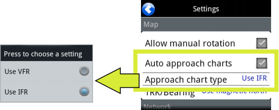
If we have downloaded the approach charts for SAEZ, then an approach chart will pop up on the map when SAEZ is our next selected waypoint.
Back to index.


