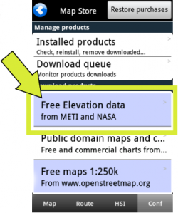
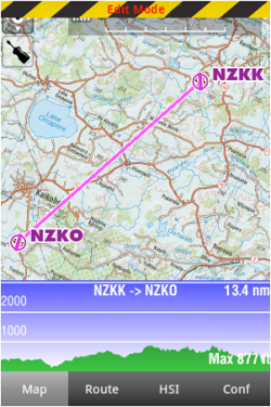
From the «Map Options» menu, you can turn on the Elevation Graph. If elevation data is installed for your region, the elevation graph will display terrain information. Note that you will show data information ONLY after downloading «Free Elevation data» files from the Map Store.
In «Flight mode», the Elevation Graph will display the terrain in front of the aircraft, updating the view every 5 seconds. The maximum reported altitude of the total distance of terrain profile in front of us will be displayed in the Graph. We can zoom in or zoom out by using two fingers to see less or more terrain. The scale is displayed in NM. A symbol representing your aircraft will show in the view with a red dashed line, representing your current altitude, as reported by the GPS.
sso é muito útil quando você planejar a sua rota para estimar a altitude mínima segura.
Note: Por favor, note que mesmo com um bom sinal GPS, a altitude captada pelo GPS terá uma precisão de +/- 200 pés. A base de dados da elevação pode ter algumas imprecisões. Você deveria sempre planejar o seu vôo com uma margem ressonável de distancia para evadir os obstáculos do terreno.
Back to index.

