(Created page with "3D Ansicht") |
(Created page with "<br /> ---- Das 3D-Ansicht Modul ist ein hilfreiches Werkzeug, das bei der Flugplanung den Höhengraphen ergänzt. Es verwendet ein professionelles digitales Höhenmodell zusa...") |
||
| Line 2: | Line 2: | ||
<br /> | <br /> | ||
---- | ---- | ||
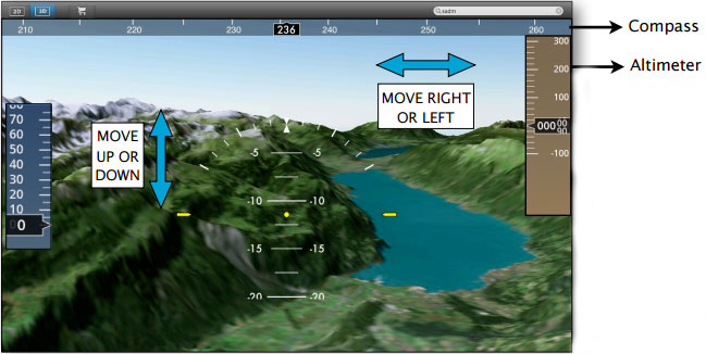
| − | + | Das 3D-Ansicht Modul ist ein hilfreiches Werkzeug, das bei der Flugplanung den Höhengraphen ergänzt. Es verwendet ein professionelles digitales Höhenmodell zusammen mit Satellitenfotos guter Qualität. Das Ergebnis ist eine sehr realistische Darstellung der Welt in 3D. | |
[[File:danger.jpg|caption|left]] The 3D view comes with '''no 3D data installed.''' 3D data is available for purchase on a per-country or per-region basis in the Map Store. | [[File:danger.jpg|caption|left]] The 3D view comes with '''no 3D data installed.''' 3D data is available for purchase on a per-country or per-region basis in the Map Store. | ||
Revision as of 17:13, 3 November 2015
Das 3D-Ansicht Modul ist ein hilfreiches Werkzeug, das bei der Flugplanung den Höhengraphen ergänzt. Es verwendet ein professionelles digitales Höhenmodell zusammen mit Satellitenfotos guter Qualität. Das Ergebnis ist eine sehr realistische Darstellung der Welt in 3D.
The 3D view comes with no 3D data installed. 3D data is available for purchase on a per-country or per-region basis in the Map Store.Use your mouse to look up or down in the view, move right or left to have a wider look of the terrain and use the mouse wheel to climb up or down.
Back to index
