(Marked this version for translation) |
|||
| Line 1: | Line 1: | ||
<languages /> | <languages /> | ||
<translate> | <translate> | ||
| − | |||
<br /> | <br /> | ||
---- | ---- | ||
Air Navigation Pro supports geo-referenced approach charts that can be opened directly over the map. | Air Navigation Pro supports geo-referenced approach charts that can be opened directly over the map. | ||
| − | + | We offer 1-year-subscription packages that include: | |
| − | We offer 1-year-subscription packages that | + | |
* Geo-referenced Approach Charts (to be used on the map) | * Geo-referenced Approach Charts (to be used on the map) | ||
* Approach Charts PDF documents (including documents with additional info) | * Approach Charts PDF documents (including documents with additional info) | ||
* Regular updates according to the Amendment cycles. | * Regular updates according to the Amendment cycles. | ||
| − | |||
These packages are acquired through the <u>[[Purchase subscriptions (Add-ons)|Addons page.]]</u> | These packages are acquired through the <u>[[Purchase subscriptions (Add-ons)|Addons page.]]</u> | ||
| − | === '''How to use the charts''' === | + | === '''How to use the charts''' === |
| − | + | ---- | |
| − | + | ||
[[File:charts.jpg]] | [[File:charts.jpg]] | ||
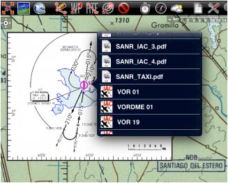
| − | + | Both can be opened by selecting a waypoint on the map. As an example on the image above, we selected the waypoint SKBG from the moving map. The files from the top are the PDF documents, while the files at the bottom are the geo-referenced approach charts classified by IFR or VFR (instrumental or visual).[[File:charts3.jpg|right|caption]] | |
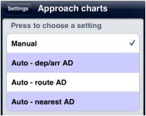
| − | Both can be opened by | + | From Settings, you can choose to open the app charts manual or automatically, for all airports in the route, only for departure and arrival or for just the nearest airport from current position. |
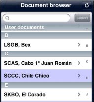
| − | From Settings, you can choose to open the app charts | + | [[File:charts2.jpg|caption|left]]The PDF documents will also be stored in the «Document browser», where we will be able to search by ICAO-code Airport and open them. |
| − | [[File:charts2.jpg|caption|left]]The PDF documents will | + | |
<br /> | <br /> | ||
| − | |||
<br /> | <br /> | ||
[[File:forbbiden.jpg|caption|left]]In order to '''hide the approach chart''' you should use the <span style="color#ff0000">'''RED'''</span> icon from the toolbar. | [[File:forbbiden.jpg|caption|left]]In order to '''hide the approach chart''' you should use the <span style="color#ff0000">'''RED'''</span> icon from the toolbar. | ||
| Line 33: | Line 27: | ||
| − | === '''Approach charts in the 3D view''' === | + | === '''Approach charts in the 3D view''' === |
| − | + | ---- | |
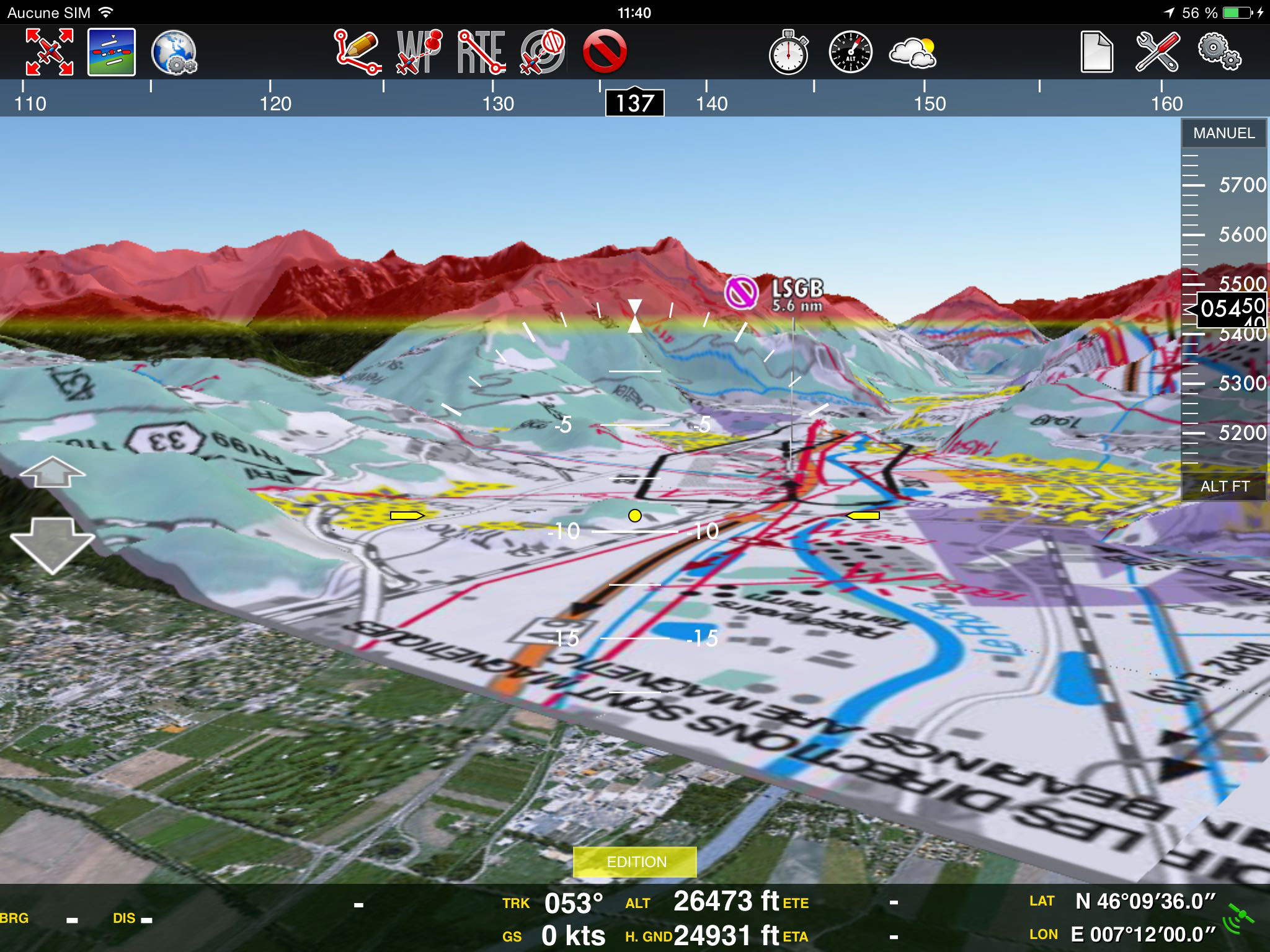
| − | + | It is possible to display approach charts in the 3D view. | |
| − | It is possible to | + | |
To do this: | To do this: | ||
* Tap on an airfield and display a georeferenced chart on the 2D view | * Tap on an airfield and display a georeferenced chart on the 2D view | ||
| Line 44: | Line 37: | ||
---- | ---- | ||
<br /> | <br /> | ||
| − | Back to <u>[[ | + | Back to <u>[[Xample Services|previous page.]]</u> |
<br /> | <br /> | ||
</translate> | </translate> | ||
Revision as of 20:03, 7 July 2016
Air Navigation Pro supports geo-referenced approach charts that can be opened directly over the map.
We offer 1-year-subscription packages that include:
- Geo-referenced Approach Charts (to be used on the map)
- Approach Charts PDF documents (including documents with additional info)
- Regular updates according to the Amendment cycles.
These packages are acquired through the Addons page.
How to use the charts
Both can be opened by selecting a waypoint on the map. As an example on the image above, we selected the waypoint SKBG from the moving map. The files from the top are the PDF documents, while the files at the bottom are the geo-referenced approach charts classified by IFR or VFR (instrumental or visual).
From Settings, you can choose to open the app charts manual or automatically, for all airports in the route, only for departure and arrival or for just the nearest airport from current position.
The PDF documents will also be stored in the «Document browser», where we will be able to search by ICAO-code Airport and open them.
Approach charts in the 3D view
It is possible to display approach charts in the 3D view. To do this:
- Tap on an airfield and display a georeferenced chart on the 2D view
- Change to the 3D View
Back to previous page.


