Line 7:
Line 7:
----
----
== Overview ==
== Overview ==
− [[File:EFIS.jpg]]
+ [[File:3defis2 .jpg]]
Revision as of 17:58, 9 March 2016
Information about message (contribute ) This message has no documentation.
If you know where or how this message is used, you can help other translators by adding documentation to this message.
Message definition (3D View )
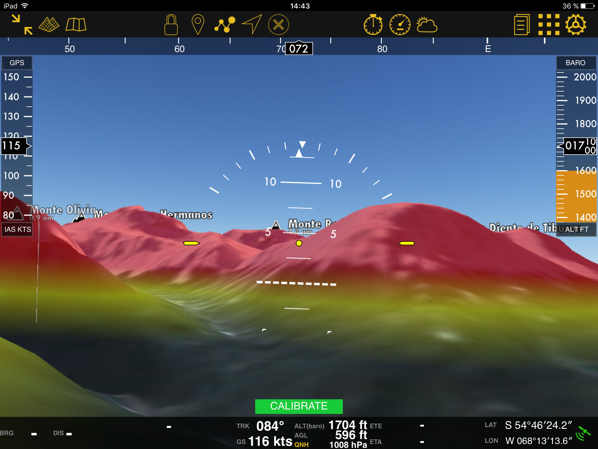
<br /> ---- The EFIS module is a graphic interface which displays real <span style="color#0000ff">3D terrain</span> while flying. In order to use it, you will first need to download the '''3D data''' from the <u>[[Map Store]]</u>. This is a complex piece of data and it works for '''both''' the EFIS module and the <u>[[Profile View]]</u>. So this means that once you have installed it in Air Navigation Pro, you won’t need to install the Free Elevation data. <br /> __TOC__ <br /> ---- == Overview == [[File:3Dversionf.jpg]]
<br />
----
The EFIS module is a graphic interface which displays real <span style="color#0000ff">3D terrain</span> while flying. In order to use it, you will first need to download the '''3D data''' from the <u>[[Map Store]]</u>. This is a complex piece of data and it works for '''both''' the EFIS module and the <u>[[Profile View]]</u>. So this means that once you have installed it in Air Navigation Pro, you won’t need to install the Free Elevation data.
<br />
__TOC__
<br />
----
== Overview ==
[[File:3Dversionf.jpg]]
Translation <br /> ---- The EFIS module is a graphic interface which displays real <span style="color#0000ff">3D terrain</span> while flying. In order to use it, you will first need to download the '''3D data''' from the <u>[[Map Store]]</u>. This is a complex piece of data and it works for '''both''' the EFIS module and the <u>[[Elevation Graph]]</u>. So this means that once you have installed it in Air Navigation Pro, you won’t need to install the Free Elevation data. <br /> __TOC__ <br /> ---- == Overview == [[File:3defis2.jpg]]
The EFIS module is a graphic interface which displays real 3D terrain while flying. In order to use it, you will first need to download the 3D data from the Map Store . This is a complex piece of data and it works for both the EFIS module and the Elevation Graph . So this means that once you have installed it in Air Navigation Pro, you won’t need to install the Free Elevation data.
Overview