(Created page with "rightDer Prozess beginnt, sobald die '''Block-off'''-Zeit unter '''«Flight Time»''' gesetzt wurde. <br /> <br /> (iOS) <br /> Sobald die „Block...") |
(Created page with "---- File:danger.jpg Um Fehler zu vermeiden sollten Sie:") |
||
| Line 21: | Line 21: | ||
---- | ---- | ||
| − | [[File:danger.jpg]] | + | [[File:danger.jpg]] Um Fehler zu vermeiden sollten Sie: |
* Enable «Live tracking service» under «Tools» menu; | * Enable «Live tracking service» under «Tools» menu; | ||
Revision as of 19:11, 25 November 2015
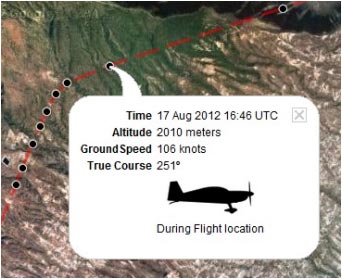
Die App sendet während des Fluges durch einen Server Wegpunkte in Echtzeit. Gleichzeitig kann sich eine weitere Person mit Ihrem Benutzerkonto einloggen und Ihren Flug anhand der Wegpunkte verfolgen. Zudem werden weitere Informationen wie aktuelle Höhe, Richtung und Zeit angezeigt.
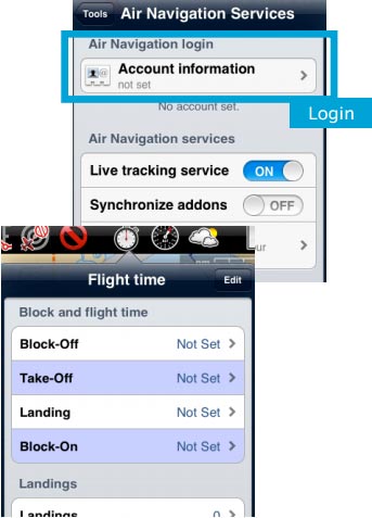
Der Prozess beginnt, sobald die Block-off-Zeit unter «Flight Time» gesetzt wurde.
(iOS)
Sobald die „Block-Off“ Zeit gesetzt wurde, beginnt Air Nav Pro den Flug live in Ihrem Benutzerkonto aufzuzeichnen.
Die Aufzeichnung endet, sobald die „Block-On“ Zeit gesetzt wurde.
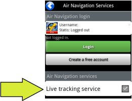 (Android)
File:Danger.jpg Um Fehler zu vermeiden sollten Sie:
- Enable «Live tracking service» under «Tools» menu;
- Be logged in with your User Account.
Note: Flight tracking system will work live as long as GSM network is available.
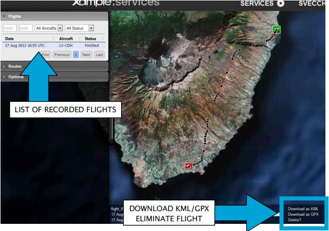
Each recorded flight will be stored on the left bar in the «AIRNAVIGATION» section of the User Account website. It can be downloaded as a KML file or as a GPX file from the right side of the bottom data bar. You can also delete a flight.
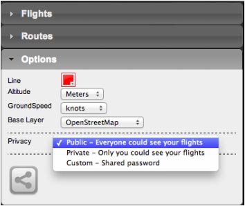
It is possible to keep the flight private or share it with family or friends with a password or set it as “public”. This can be configured from the «Options» tab on the left bar.
From this tab, it is also possible to change the units for altitude and speed, change the color of the track line and even switching to a bunch of varied map backgrounds.
Back to index (Android)
Back to index (iOS)
