(Created page with "'''Wegpunkte:''' ID Code, Höhe, Symboltyp, vollständigen Namen, Breite, Länge, Frequenz (Navaids), Landebahn und Frequenz-Informationen (Flughafen), georeferenzierte Anflug...") |
(Created page with "'''Luftraum:''' untere und obere Grenzen, Name, Klasse und zusätzliche Informationen. Diese Lufträume sind auf der Karte in verschiedenen Farben je nach Klasse aufgezeichnet.") |
||
| Line 21: | Line 21: | ||
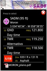
'''Wegpunkte:''' ID Code, Höhe, Symboltyp, vollständigen Namen, Breite, Länge, Frequenz (Navaids), Landebahn und Frequenz-Informationen (Flughafen), georeferenzierte Anflugkarten. | '''Wegpunkte:''' ID Code, Höhe, Symboltyp, vollständigen Namen, Breite, Länge, Frequenz (Navaids), Landebahn und Frequenz-Informationen (Flughafen), georeferenzierte Anflugkarten. | ||
| − | ''' | + | '''Luftraum:''' untere und obere Grenzen, Name, Klasse und zusätzliche Informationen. Diese Lufträume sind auf der Karte in verschiedenen Farben je nach Klasse aufgezeichnet. |
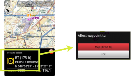
You can press on any of the waypoints in the map to assign it to the HSI instrument or to select it as your destination, by pressing where it says: | You can press on any of the waypoints in the map to assign it to the HSI instrument or to select it as your destination, by pressing where it says: | ||
Revision as of 19:47, 18 November 2015
Sie können durch die Moving Map eine Route erstellen. Es ist auch möglich dazwischenliegende Wegpunkte auf der aktuellen Route, während des Fluges, zu setzen. (um schlechte klimatische Bedingungen zu vermeiden)
Durch Drücken des Kompassrose Symbols in der oberen rechten Ecke des Bildschirms können Sie zwischen folgenden Einstellungen wechseln:
Touching an area of interest on the map will reveal a popup window with useful information. Touchable or interactive items are:
Wegpunkte: ID Code, Höhe, Symboltyp, vollständigen Namen, Breite, Länge, Frequenz (Navaids), Landebahn und Frequenz-Informationen (Flughafen), georeferenzierte Anflugkarten.
Luftraum: untere und obere Grenzen, Name, Klasse und zusätzliche Informationen. Diese Lufträume sind auf der Karte in verschiedenen Farben je nach Klasse aufgezeichnet.
You can press on any of the waypoints in the map to assign it to the HSI instrument or to select it as your destination, by pressing where it says: Press to select
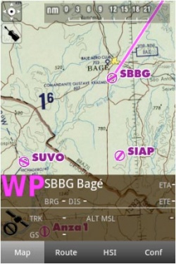
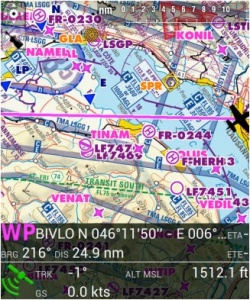
The data bar at the bottom of the moving map will display real-time information. From left to right: ID and name of next waypoint; bearing, track and distance of next waypoint; groundspeed and altitude as reported by the GPS signal, and estimated time to the next waypoint.
The data bar also shows a GPS signal symbol as follows:
Excellent GPS signal
Good GPS signal
Weak GPS signal
Very week GPS signal
For real time navigation, the quality of the GPS signal is required to be a green or yellow symbol. A red or orange symbol will only show an approximate location and will not report speed nor track information.For better results, place your device near a window, with a direct view of the sky. If you are flying with a full-metal airplane or your airplane is equipped with anti-ice windshield, the internal GPS of your tablet/mobile may be a bit weak and you may need an external GPS device to assist it.
Back to index.


