(Importing a new version from external source) |
(Updating to match new version of source page) |
||
| Line 9: | Line 9: | ||
* Regular updates according to the Amendment cycles. | * Regular updates according to the Amendment cycles. | ||
<br/> | <br/> | ||
| − | To purchase a subscription, read the article <u>[[ | + | To purchase a subscription, read the article <u>[[Installing maps and charts|Installation]].</u> |
Latest revision as of 19:14, 30 November 2015
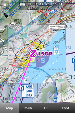
Air Navigation Pro supports geo-referenced approach charts that can be opened directly over the map.
We offer a 1-year-subscription package that includes:
- Geo-referenced Approach Charts to be used on the map.
- Approach Charts PDF documents (with additional info).
- Regular updates according to the Amendment cycles.
To purchase a subscription, read the article Installation.
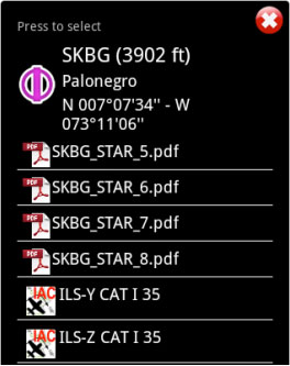
Both can be opened by selecting a waypoint on the map.
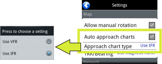
As an example, we selected the waypoint SKBG from the moving map. The files from the top are the PDF documents, while the files at the bottom are the geo-referenced approach charts classified by IFR or VFR (instrumental or visual).
Example: if I create a Route: SKBG - SKBO - SAEZ.
If we have downloaded the approach charts for SAEZ, then an approach chart will pop up on the map when SAEZ is our next selected waypoint.
Back to index.


