(Created page with "La posición de reporte siempre se muestra.") |
(Created page with "---- <u>'''Nota'''</u>: Por favor, tenga en cuenta que los docks de iPhone solo serán visibles en iPhone 6 y otros con pantallas más grandes. ----") |
||
| Line 18: | Line 18: | ||
---- | ---- | ||
| − | + | There are four kinds of Docks:<br /> | |
| + | *PR<br /> | ||
*DEP<br /> | *DEP<br /> | ||
*ARR<br /> | *ARR<br /> | ||
*ALTN<br /> | *ALTN<br /> | ||
<br /> | <br /> | ||
| − | + | Tapping on one of the docks, will open up a tab with information related to the waypoint or your position. To close this tab just tap anywhere on the map. | |
---- | ---- | ||
| − | <u>''' | + | <u>'''Nota'''</u>: Por favor, tenga en cuenta que los docks de iPhone solo serán visibles en iPhone 6 y otros con pantallas más grandes. |
---- | ---- | ||
Revision as of 16:49, 4 April 2017
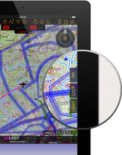
The docks offer you a quick access to relevant information about Departure, Arrival, Alternate airport and your current position.
They will appear on the right side of the moving map after a route is created or loaded.
La posición de reporte siempre se muestra.
Nota: Es posible configurar un aeropuerto alterno presionando en el resumen de rutas y agregando el ID del aeródromo en el campo alterno.
There are four kinds of Docks:
- PR
- DEP
- ARR
- ALTN
Tapping on one of the docks, will open up a tab with information related to the waypoint or your position. To close this tab just tap anywhere on the map.
Nota: Por favor, tenga en cuenta que los docks de iPhone solo serán visibles en iPhone 6 y otros con pantallas más grandes.
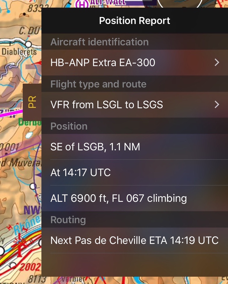
PR Position Report
The purpose of this dock is to help you when contacting ATC on the initial call. It will display your current position and intentions in a manner that will quickly let you transmit it over the radio.
Airports Docks
The DEP, ARR and ALTN tabs have four pages:
Contents
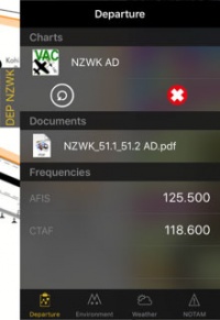
Departure/Approach
On this page you will have access to the charts and documents (*). You will also see the frequencies of the airfield. When tapping on the chart, it will be displayed on the moving map. By tapping on the red cross the chart will be closed. Tapping on the circled arrow will change to the next chart.
You can also see personal .pdf documents that were attached to the airfield.
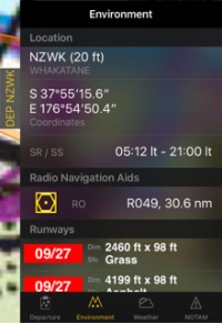
Ambiente
Se mostrará información sobre la ubicación del aeródromo y sus alrededores:- Altura
- Coordenadas
- Hora de salida/puesta del sol
- Radio ayudas de navegación: distancia y radial
- Pistas
- Obstáculos (*)
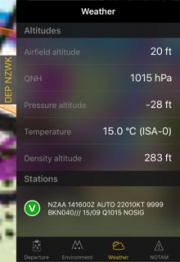
Clima
Recopila información del clima de las estaciones climáticas cercanas al aeródromo. La aplicación calculará altitudes tomando en cuenta el clima actual. También mostrará el METAR. Presionando sobre una estación, se podrá ver el reporte de TAF.
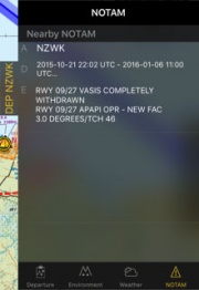
NOTAM
Los Notams cercanos serán mostrados. Para que esta página funcione, será necesario pedir un briefing antes. (*)
Nota: Si hay información faltante (clima, NOTAM, etc.), cambiando del Modo Edit al Modo Flight actualizará los datos de las docks.
Las docks pueden ser desactivadas en "Configuración" - "Docks de información".
(*) Para que estas funciones funcionen, será necesaria la suscripción a los servicios mencionados (Preflight Briefing, Cartas de Aproximación, Base de datos de Obstáculos).
Back to previous page.
