(Marked this version for translation) |
|||
| Line 75: | Line 75: | ||
Back to <u>[[Air_Navigation_overview|previous page.]]</u> | Back to <u>[[Air_Navigation_overview|previous page.]]</u> | ||
<br /> | <br /> | ||
| + | [[Category:Overview]] | ||
[[Category:Moving Map]] | [[Category:Moving Map]] | ||
</translate> | </translate> | ||
Revision as of 14:33, 20 October 2016
In the Moving Map you will be able to interact with everything that is shown on the screen.
Contents
Compass Rose
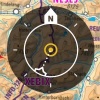
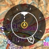
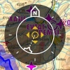
The compass rose in the top right corner will indicate in a graphical way the orientation of the map, your current track and the mode currently selected. To change between modes, tap on the rose.
North up
The moving map is oriented northwards. Your current position will be centered on the moving map. Notice the N arrow is now white.
Track up
The moving map is oriented towards your current track. Your current position will be centered on the moving map. Notice the track lines is now white.
Free Mode
The free mode activates automatically when moving away from your current position. It is identified by the 4 arrows on the icon. When tapping on the rose in this mode the chart will move back to your current location.
If the function "Allow manual rotation" is activated, this mode will also activate by rotating the map.
Ruler
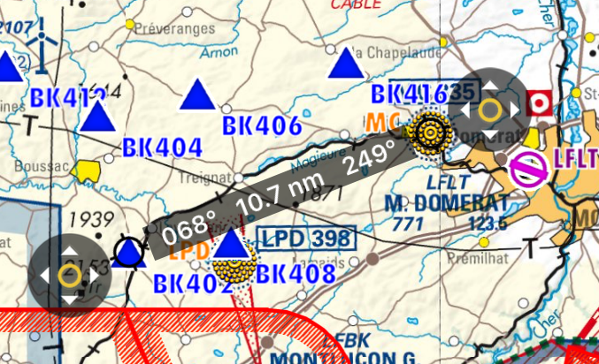
Tap on two places at the same time for two seconds to enable the ruler. It will allow you to measure the distance between two locations on the map and the true bearing between them.
The ruler is "magnetic", it snaps to the nearest waypoint, and it snaps to your aircraft (but it won't follow your aircraft when it moves).
You can move one of the ends of the ruler by tapping on the symbol with the 4 arrows.
Tapping anywhere else on the map will disable the ruler.
Rotate
Move two fingers around each other to rotate the view of the map. Remember that this function has to be enabled from "Settings" menu.
Zoom in / out
Pinch with two fingers to zoom in or out. You can also swipe left or right on the scale to zoom in or out or tap on the "+" "-" symbols.
Screen lock / notepad
It is possible to lock the screen by swiping three fingers from right to left over the moving map and use it as a notepad.
Out of screen symbol
When the aircraft is out of the screen, a symbol will be shown on the edge of the moving map in the direction where the aircraft is. You can tap on the symbol to center the aircraft on the screen again.
Troubleshooting
- The map looks yellow and red, not like the original map
- This happens when the option "Terrain awareness 2D/3D" is turned on. Air Navigation will show terrain at your current altitude in yellow and terrain above your current altitude in red. This is very useful in flight but can be a bit disturbing while planning your flight on the ground. You can disable it from Map Options.
For more information about what can be done in the Moving Map, please refer to Map Options.
Back to previous page.
