(Created page with "---- left Os pacotes tais como os dados 3D, o Preflight Brefing, e as cartas de aproximação, e outras assinaturas não aparecerão neste menu, ma...") |
(Created page with "<u>'''Widgets'''</u> Várias opções, que aparecerão no mapa em movimento, podem ser ativadas a partir desta janela:") |
||
| Line 34: | Line 34: | ||
<u>'''Widgets'''</u> | <u>'''Widgets'''</u> | ||
| − | + | Várias opções, que aparecerão no mapa em movimento, podem ser ativadas a partir desta janela: | |
*METAR stations | *METAR stations | ||
Revision as of 15:00, 24 November 2015
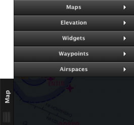
A aba “Map” tem 5 módulos:
Maps (mapas)
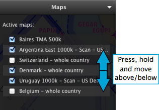
Os mapas baixados são encontrados aqui. Estes podem ser reorganizados, movendoos para cima ou para baixo. Além do mais, eles podem ser ativados ou desativados à vontade.
Os pacotes tais como os dados 3D, o Preflight Brefing, e as cartas de aproximação, e outras assinaturas não aparecerão neste menu, mais sim na seção «My products» do Map Store.
Elevation (elevação)
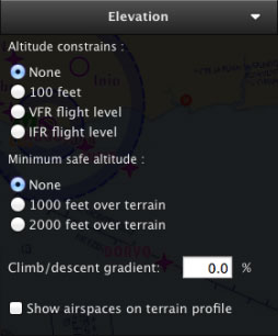
Neste módulo ficam as configurações para o gráfico de terreno. Restrições de altitude, altitude mínima segura, e o gradiente de subida e descida são opções que também estão disponíveis. Você pode mostrar/ocultar os espaços aéreos no gráfico de elevação através deste módulo.
Widgets
Várias opções, que aparecerão no mapa em movimento, podem ser ativadas a partir desta janela:
- METAR stations
- NOTAM info
- Runway extensions
- Labels of distance/course on leg vectors
- Map of Obstacles
Waypoints
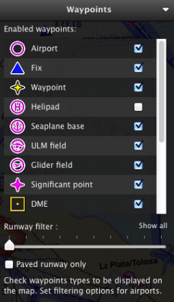
- Airport
- Fix (Visual Reporting Point)
- User Waypoint (waypoint created by the user)
- Helipad
- Seaplane base
- ULM field
- Glider field
- Significant point (IFR waypoint)
- DME
- NDB
- VOR
- NDB DME
- VOR DME
- TACAN
- VORTAC
For Airfields, it is also possible to filter by runway length and surface type.
Airspaces
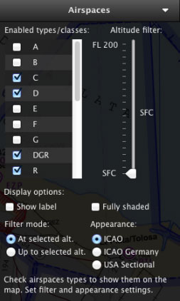
A bunch of varied filters and options are available in this module:Airspace Class filter: A, B, C, D, E, F, G, Danger (DGR), Restricted (R), Prohibited (P), Glider Prohibited (GP), Glider (WW), TSA, TRA, MATZ (MIL). Recreational (RCT), Nature Reserve (NR), FIR. Airspace Altitude filter Airspace Appearance selection.
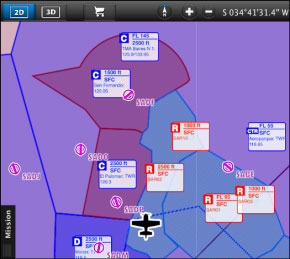
There are also options to display the Airspaces fully-shaded and show a window label with information about them.
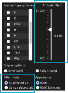
In order to correctly configure the Airspace altitude filters, you should take into account both the Altitude filter and the Filter mode.
The example on the left shows the altitude filter set to FL120, and the filter mode set to “At selected altitude”. This means that the map will only show Airspaces which have vertical limits within FL120.
If you change the filter mode to “Up to selected altitude” the map will show ALL the Airspaces from the surface up to FL120.
To display ALL Airspaces, you will set the altitude filter to FL200 like in the image on the right.
Back to index
