| Line 17: | Line 17: | ||
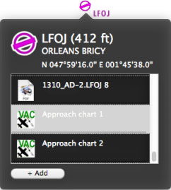
| − | + | The approach chart can be opened as a PDF document. Or it can be displayed on the map to better plan the route. In both cases, you have to '''select them in the info window''' of the airport waypoint. | |
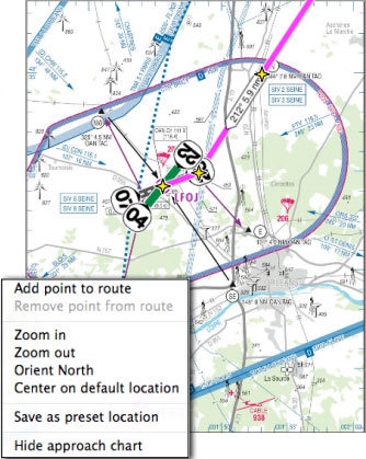
[[File:geo_mac2.jpg|caption|left]] Este es un ejemplo en el cual se abre y geo referencia en el mapa móvil una carta correspondiente al aeródromo LFOJ. | [[File:geo_mac2.jpg|caption|left]] Este es un ejemplo en el cual se abre y geo referencia en el mapa móvil una carta correspondiente al aeródromo LFOJ. | ||
| Line 37: | Line 37: | ||
---- | ---- | ||
| − | < | + | <br /> |
Volver al <u>[[Air Navigation Desktop/es|índice]]</u>. | Volver al <u>[[Air Navigation Desktop/es|índice]]</u>. | ||
<br /> | <br /> | ||
Revision as of 20:23, 16 November 2015
Como complemento, Air Navigation Desktop soporta cartas de aproximación geo referenciadas.
caption Las cartas de aproximación geo referenciadas son suscripciones pagas y deben comprarse desde una cuenta de Xample Services.
The approach chart can be opened as a PDF document. Or it can be displayed on the map to better plan the route. In both cases, you have to select them in the info window of the airport waypoint.
Hacer clic con el botón derecho sobre el mapa móvil y seleccionar «Hide approach chart» desde la ventana emergente para ocultar la carta.
Volver al índice.

