(Importing a new version from external source) |
(No difference)
|
Latest revision as of 17:55, 20 October 2015
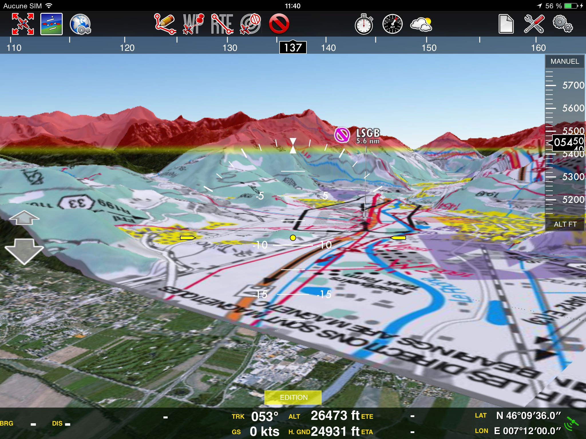
It is possible to show approach charts in the 3D view. To do this:
- Tap on an airfield and display a georeferenced chart on the 2D view
- Change to the 3D View
Back to index
