(Marked this version for translation) |
|||
| Line 12: | Line 12: | ||
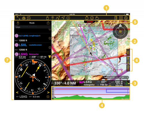
;# [[Moving Map]] | ;# [[Moving Map]] | ||
;# [[Data Bar]] | ;# [[Data Bar]] | ||
| − | ;# [[ | + | ;# [[Profile View]] |
;# [[Sensor Status]] | ;# [[Sensor Status]] | ||
;# [[Docks]] | ;# [[Docks]] | ||
| Line 27: | Line 27: | ||
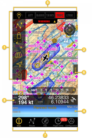
;# [[Moving Map]] | ;# [[Moving Map]] | ||
;# [[Data Bar]] | ;# [[Data Bar]] | ||
| − | ;# [[ | + | ;# [[Profile View]] |
;# [[Sensor Status]] | ;# [[Sensor Status]] | ||
;# [[Docks]] | ;# [[Docks]] | ||
Latest revision as of 19:33, 8 June 2017
Air Navigation is a very intuitive software. The User interface was developed to show all flight-important information at a glance. As a general rule, you can interact on the overview with everything that is yellow, everything on grey/white is information.
iPad
iPhone
Note: Please note that iPhone's docks will only be visible in iPhone 6 and others with bigger screens.
Back to previous page.

