(Created page with "Si la función "Rotar mapa" está activada, este modo se activará también al rotar el mapa.") |
(Created page with "=== Regla === Para activar la regla, presione en dos lugar al mismo tiempo. Le permitirá medir la distancia entre dos sitios en el mapa y el curso verdadero entre ellos.") |
||
| Line 27: | Line 27: | ||
---- | ---- | ||
| − | === | + | === Regla === |
| − | + | Para activar la regla, presione en dos lugar al mismo tiempo. Le permitirá medir la distancia entre dos sitios en el mapa y el curso verdadero entre ellos. | |
[[File:Ruler.png]] | [[File:Ruler.png]] | ||
Revision as of 20:23, 16 November 2016
Es posible interactuar con todo lo que se muestra en el mapa móvil.
Contents
Rosa de los vientos
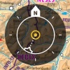
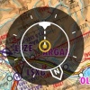
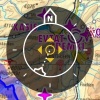
La rosa de los vientos ubicada en la esquina superior derecha indicará la orientación del mapa, el rumbo actual y el modo seleccionado. Para cambiar de modo, solo hay que presionar en la rosa de los vientos.
Dirección Norte
El mapa móvil está orientado hacia el Norte. Su posición actual se centrará en el mapa. La flecha N se pondrá en blanco.
Dirección de rumbo
El mapa móvil será orientado hacia el rumbo actual. Su posición actual será centrada en el mapa. Las líneas del rumbo se pondrán en blanco.
Modo Libre
El Modo Libre se activará automáticamente cuando se mueva de su posición actual. Puede ser identificado por las 4 flechas en el ícono. Al presionar en la rosa de los vientos estando en este modo, la carta se centrará nuevamente en su posición actual.
Si la función "Rotar mapa" está activada, este modo se activará también al rotar el mapa.
Regla
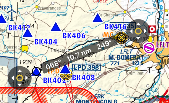
Para activar la regla, presione en dos lugar al mismo tiempo. Le permitirá medir la distancia entre dos sitios en el mapa y el curso verdadero entre ellos.
The ruler is "magnetic", it snaps to the nearest waypoint, and it snaps to your aircraft (but it won't follow your aircraft when it moves).
You can move one of the ends of the ruler by tapping on the symbol with the 4 arrows.
Tapping anywhere else on the map will disable the ruler.
Rotate
Move two fingers around each other to rotate the view of the map. Remember that this function has to be enabled from "Settings" menu.
Zoom in / out
Pinch with two fingers to zoom in or out. You can also swipe left or right on the scale to zoom in or out or tap on the "+" "-" symbols.
Screen lock / notepad
It is possible to lock the screen by swiping three fingers from right to left over the moving map and use it as a notepad.
Out of screen symbol
When the aircraft is out of the screen, a symbol will be shown on the edge of the moving map in the direction where the aircraft is. You can tap on the symbol to center the aircraft on the screen again.
Troubleshooting
- The map looks yellow and red, not like the original map
- This happens when the option "Terrain awareness 2D/3D" is turned on. Air Navigation will show terrain at your current altitude in yellow and terrain above your current altitude in red. This is very useful in flight but can be a bit disturbing while planning your flight on the ground. You can disable it from Map Options.
For more information about what can be done in the Moving Map, please refer to Map Options.
Back to previous page.
