Line 13:
Line 13: Volver a la <u>[[Tools/es|página anterior.]]</u>
Volver a la <u>[[Tools/es|página anterior.]]</u>
<br />
<br />
− [[Category:Tools]]
Revision as of 20:47, 28 October 2016
Information about message (contribute ) This message has no documentation.
If you know where or how this message is used, you can help other translators by adding documentation to this message.
Message definition (Custom waypoints editor )
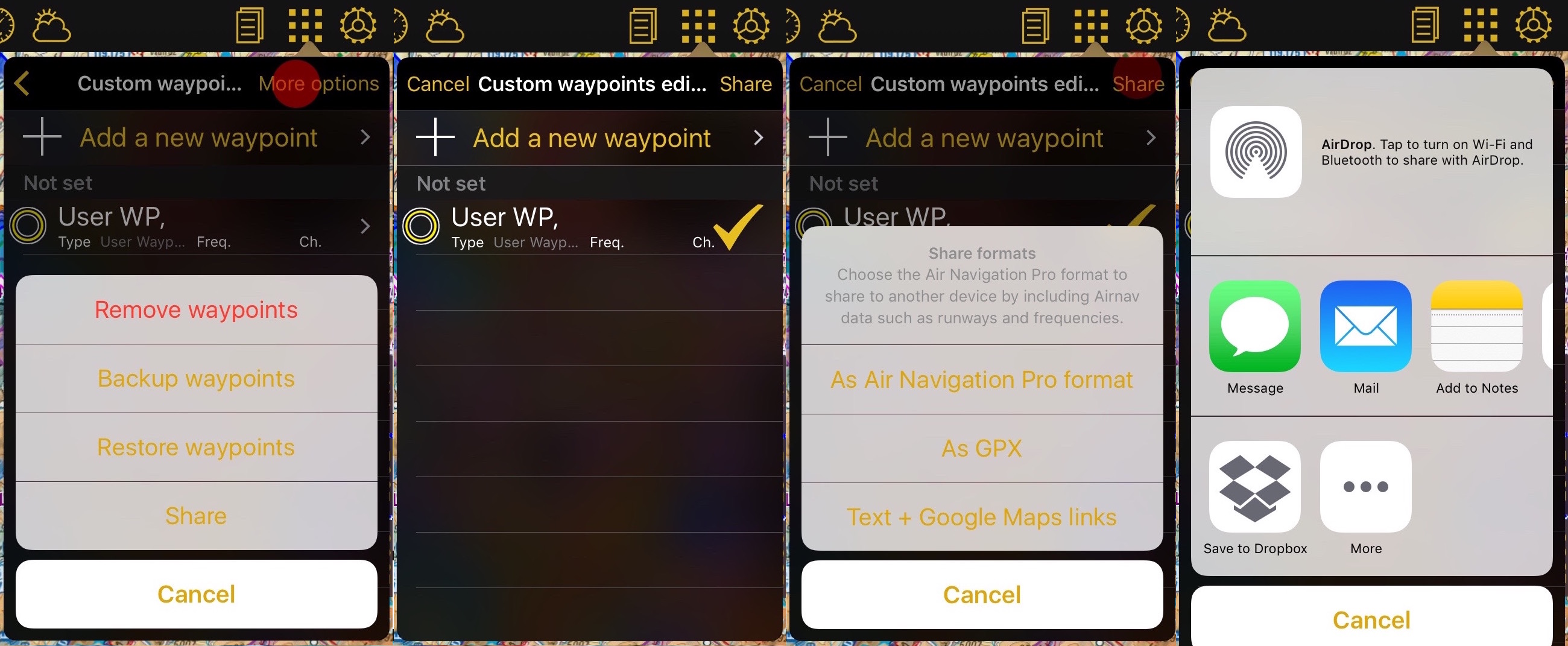
You will be given the option to choose between different formats.
You will be given the option to choose between different formats.
*Air Navigation Pro format: This format includes all the information related to the waypoint, like frequency and runways informations. Only compatible with Air Navigation Pro.
*GPX: compatible with third party softwares that supports this type of files.
*Text + Google Maps link
<br />
Once you select the waypoint you can choose how you would like to share it:
*[//support.apple.com/en-us/HT204144 AirDrop]
*iOS Native apps like Message, Mail or Notes
*Third party apps like Dropbox.
<br />
[[File:waypoints_share.jpg]]
----
Back to <u>[[Tools|previous page.]]</u>
<br />
[[Category:Tools]]
Translation Tendrá la opción de elegir entre diferentes formatos. Tendrá la opción de elegir entre diferentes formatos.
Formato Air Navigation Pro: este formato incluye toda la información relacionada con los waypoints como información de frecuencia y pista. Sólo compatible con Air Navigation Pro.
GPX: compatible con programas de terceros que soportan este tipo de archivos.
Texto + enlace Google Maps
AirDrop Aplicaciones nativas de iOS como Message, Mail o Notes
Aplicaciones de terceros como Dropbox.
Volver a la página anterior.
