(Updating to match new version of source page) |
(Updating to match new version of source page) |
||
| Line 36: | Line 36: | ||
Each recorded flight will be stored on the left bar in the '''«AIRNAVIGATION»''' section of the User Account website. It can be downloaded as a '''KML file''' or as a '''GPX file''' from the right side of the bottom data bar. You can also delete a flight. | Each recorded flight will be stored on the left bar in the '''«AIRNAVIGATION»''' section of the User Account website. It can be downloaded as a '''KML file''' or as a '''GPX file''' from the right side of the bottom data bar. You can also delete a flight. | ||
| − | [[File: | + | [[File:livetracking.jpg]] |
#List of recorded flights. | #List of recorded flights. | ||
Revision as of 15:22, 21 October 2016
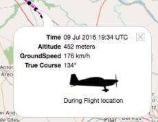
The application will send points through the server in real time as the flight is being performed and at the same time a person connected with your User Account is able to check those points that build the track and has relevant information such as current altitude, heading and time.
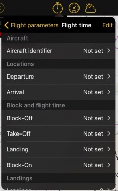
The process will start when the Block-off time has been set in the «Flight Time» module.
(iOS)
Remember that it can be automatically configured in the settings.
Once Block-of time is set, Air Navigation Pro will record the flight live to your User Account.
The recording will finish as soon as the Block-on time is established.
 (Android)
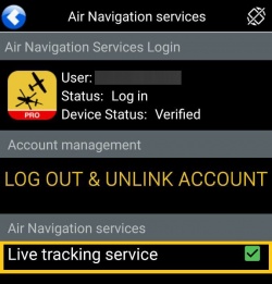
![]() To avoid issues, make sure to:
To avoid issues, make sure to:
- Enable «Live tracking service» under «Tools» menu;
- Be logged in with your User Account.
Note: Flight tracking system will work live as long as GSM network is available.
Each recorded flight will be stored on the left bar in the «AIRNAVIGATION» section of the User Account website. It can be downloaded as a KML file or as a GPX file from the right side of the bottom data bar. You can also delete a flight.
- List of recorded flights.
- Download KML/GPX. Delete flight.
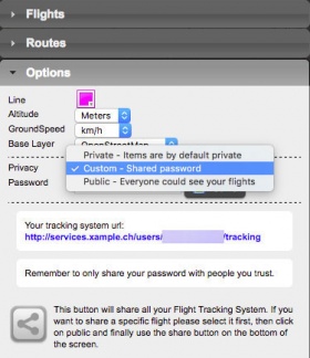
It is possible to keep the flight private or share it with family or friends with a password or set it as “public”. This can be configured from the «Options» tab on the left bar.
From this tab, it is also possible to change the units for altitude and speed, change the color of the track line and even switching to a bunch of varied map backgrounds.
Back to index (Android)
Back to previous page. (iOS)


