(Created page with "Der freie Modus aktiviert sich automatisch beim berühren und bewegen der Moving Map. Es wird durch die 4 Pfeile im Icon-Zentrum gekennzeichnet. Beim Tippen auf der Rose in di...") |
(Updating to match new version of source page) |
||
| Line 12: | Line 12: | ||
Moving Map nach Norden ausgerichtet. Ihre aktuelle Position wird in der Mitte des Moving Maps angezeigt. Der Modus wird durch das weiße "N" gekennzeichnet. | Moving Map nach Norden ausgerichtet. Ihre aktuelle Position wird in der Mitte des Moving Maps angezeigt. Der Modus wird durch das weiße "N" gekennzeichnet. | ||
| − | |||
====Course-up==== | ====Course-up==== | ||
| Line 18: | Line 17: | ||
Die Moving Map orientiert sich nach ihren aktuellen Flugkurs. Ihre aktuelle Position wird im unteren Drittel des Bildschirms angezeigt. Der Modus wird durch die weiße Kurslinie gekennzeichnet. | Die Moving Map orientiert sich nach ihren aktuellen Flugkurs. Ihre aktuelle Position wird im unteren Drittel des Bildschirms angezeigt. Der Modus wird durch die weiße Kurslinie gekennzeichnet. | ||
| − | |||
====Freier Modus==== | ====Freier Modus==== | ||
| Line 24: | Line 22: | ||
Der freie Modus aktiviert sich automatisch beim berühren und bewegen der Moving Map. Es wird durch die 4 Pfeile im Icon-Zentrum gekennzeichnet. Beim Tippen auf der Rose in diesem Modus zentriert sich die Moving Map auf Ihre aktuelle Position. | Der freie Modus aktiviert sich automatisch beim berühren und bewegen der Moving Map. Es wird durch die 4 Pfeile im Icon-Zentrum gekennzeichnet. Beim Tippen auf der Rose in diesem Modus zentriert sich die Moving Map auf Ihre aktuelle Position. | ||
| + | |||
| + | If the function "[[Settings#Map|Allow manual rotation]]" is activated, this mode will also activate by rotating the map. | ||
---- | ---- | ||
| + | |||
=== Ruler === | === Ruler === | ||
Tap on two places at the same time for two seconds to enable the ruler. It will allow you to measure the distance between two locations on the map and the true bearing between them. | Tap on two places at the same time for two seconds to enable the ruler. It will allow you to measure the distance between two locations on the map and the true bearing between them. | ||
Revision as of 18:20, 7 October 2016
Sie können mit allen Objekten, die auf der Moving Map angezeigt sind, interagieren:
Contents
Kompassrose
Die Kompassrose in der oberen linken Ecke stellt Ihren aktuellen Kurs und Kartenmodus graphisch dar. Um den Kartenmodus zu ändern tippen Sie auf der Rose.
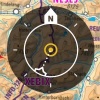
North-up
Moving Map nach Norden ausgerichtet. Ihre aktuelle Position wird in der Mitte des Moving Maps angezeigt. Der Modus wird durch das weiße "N" gekennzeichnet.
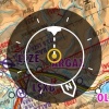
Course-up
Die Moving Map orientiert sich nach ihren aktuellen Flugkurs. Ihre aktuelle Position wird im unteren Drittel des Bildschirms angezeigt. Der Modus wird durch die weiße Kurslinie gekennzeichnet.
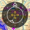
Freier Modus
Der freie Modus aktiviert sich automatisch beim berühren und bewegen der Moving Map. Es wird durch die 4 Pfeile im Icon-Zentrum gekennzeichnet. Beim Tippen auf der Rose in diesem Modus zentriert sich die Moving Map auf Ihre aktuelle Position.
If the function "Allow manual rotation" is activated, this mode will also activate by rotating the map.
Ruler
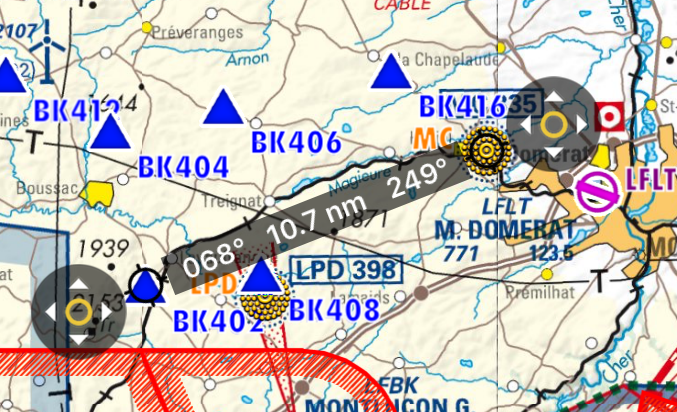
Tap on two places at the same time for two seconds to enable the ruler. It will allow you to measure the distance between two locations on the map and the true bearing between them.
The ruler is "magnetic", it snaps to the nearest waypoint, and it snaps to your aircraft (but it won't follow your aircraft when it moves).
You can move one of the ends of the ruler by tapping on the symbol with the 4 arrows.
Tapping anywhere else on the map will disable the ruler.
Rotate
Move two fingers around each other to rotate the view of the map. Remember that this function has to be enabled from "Settings" menu.
Zoom in / out
Pinch with two fingers to zoom in or out. You can also swipe left or right on the scale to zoom in or out or tap on the "+" "-" symbols.
Screen lock / notepad
It is possible to lock the screen by swiping three fingers from right to left over the moving map and use it as a notepad.
Out of screen symbol
When the aircraft is out of the screen, a symbol will be shown on the edge of the moving map in the direction where the aircraft is. You can tap on the symbol to center the aircraft on the screen again.
Troubleshooting
- The map looks yellow and red, not like the original map
- This happens when the option "Terrain awareness 2D/3D" is turned on. Air Navigation will show terrain at your current altitude in yellow and terrain above your current altitude in red. This is very useful in flight but can be a bit disturbing while planning your flight on the ground. You can disable it from Map Options.
For more information about what can be done in the Moving Map, please refer to Map Options.
Back to previous page.
