| Line 6: | Line 6: | ||
[[File:track.jpg]] | [[File:track.jpg]] | ||
| − | [[File:track1.jpg|leyenda|right]] | + | [[File:track1.jpg|leyenda|right]]L’enregistrement du vol dans le compte d’utilisateur commencera lorsque l’heure du '''Block-off''' est renseignée dans le menu '''«Temps de vol»'''. |
<br /> | <br /> | ||
<br /> | <br /> | ||
(iOS) | (iOS) | ||
<br /> | <br /> | ||
| − | + | Il sera arrêté dès le '''Block-on''' sera établi. | |
| − | + | ||
| − | + | ||
<br /> | <br /> | ||
<br /> | <br /> | ||
Revision as of 15:38, 25 November 2015
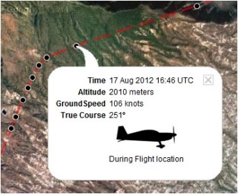
Air Navigation Pro enverra des informations sur l’altitude, le cap, l’heure et la vitesse à nos serveurs en temps réel. Ces informations peuvent être partagées avec des amis ou des membres de la famille qui sont connectés à votre compte pendant ou après le vol.
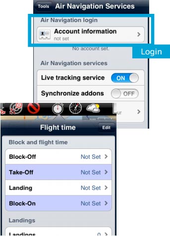
L’enregistrement du vol dans le compte d’utilisateur commencera lorsque l’heure du Block-off est renseignée dans le menu «Temps de vol».
(iOS)
Il sera arrêté dès le Block-on sera établi.
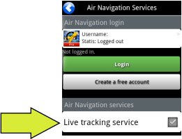 (Android)
File:Danger.jpg To avoid issues, make sure to:
- Enable «Live tracking service» under «Tools» menu;
- Be logged in with your User Account.
Note: Flight tracking system will work live as long as GSM network is available.
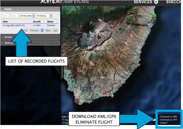
Each recorded flight will be stored on the left bar in the «AIRNAVIGATION» section of the User Account website. It can be downloaded as a KML file or as a GPX file from the right side of the bottom data bar. You can also delete a flight.
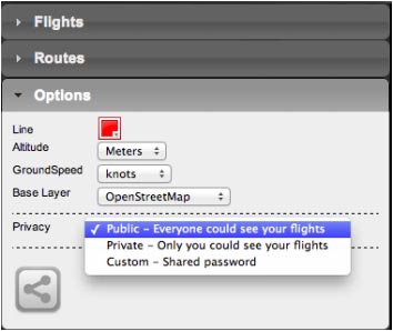
It is possible to keep the flight private or share it with family or friends with a password or set it as “public”. This can be configured from the «Options» tab on the left bar.
From this tab, it is also possible to change the units for altitude and speed, change the color of the track line and even switching to a bunch of varied map backgrounds.
Back to index (Android)
Back to index (iOS)
