(Created page with "Anexar um arquivo PDF a um waypoint") |
(Created page with "<br /> ---- Um documento PDF pode ser adicionado a '''QUALQUER''' waypoint da banco de dados.") |
||
| Line 2: | Line 2: | ||
<br /> | <br /> | ||
---- | ---- | ||
| − | + | Um documento PDF pode ser adicionado a '''QUALQUER''' waypoint da banco de dados. | |
The purpose of this can be one of the following: | The purpose of this can be one of the following: | ||
Revision as of 13:36, 19 November 2015
Um documento PDF pode ser adicionado a QUALQUER waypoint da banco de dados.
The purpose of this can be one of the following:
- Add an Aerodrome chart diagram to an Airfield from the map
- Add a PDF sheet to correct/complement any waypoint’s data
- Add a PDF sheet with additional information such as:
- contact frequency
- approach instructions
- info about the place
- photos to recognize the area
- etc.
The procedure to ATTACH a PDF document to a waypoint is as follows:
- Create a folder in the /sdcard/ folder of the Android device:
- (for devices WITHOUT sdcard, create them in the root folder) create /AirNavPro
- Create another folder inside /AirNavPro/ create /user_app_charts
- Create a folder with the ID of the waypoint inside /user_app_charts/
- Example 1: I have a PDF document for SADM then we will create /SADM
- Example 2: I have a PDF document for “la colorada” then we will create /la colorada
- Copy the PDF document inside the ID folder
- Example 1: we should have /sdcard/AirNavPro/user_app_charts/SADM/document.PDF
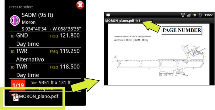
To OPEN the PDF document, you will select the waypoint directly on the map.
Back to index.
